Consulate of Sierra Leone in Syria

Geography & Climate

Geography

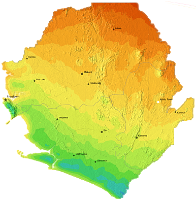
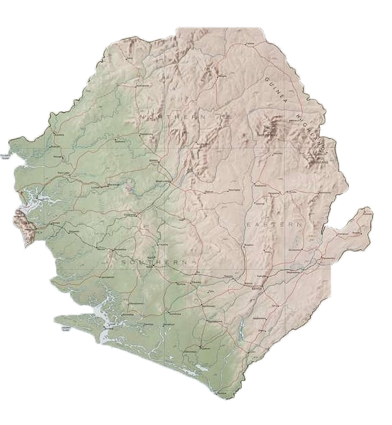
The Republic of Sierra Leone is situated on the West Coast of Africa, with a total area of 71,740 square kilometers. The capital of the nation is Freetown.

Sierra Leone shares 794 km of its borders with the Republic of Guinea from the North and Northeast, and 299km with Liberia on the East and Southeast, and the Atlantic Ocean on the South and West.
The coastline of Sierra Leone stretches for around 402km.

The land is broken up into four quadrants: Guinean mangroves (essentially swamps along the coastline), forested hills, plateaus high above sea level, and mountains in the east.
Climate

The climate in Sierra Leone is tropical. There are two main seasons : Rainy and Dry with hot and humid weather most of the time.

Temperature can range between 20 to 30 degrees Celsius on the coastal regions, with colder temperatures in the northeastern regions.

The Rainy Season lasts from May to Octobre. During these months, especially between July and August, you can expect minimum sunlight, almost daily rain , and cloudy skies. 

The Dry Season lasts from November to April is hot with dry wind coming from the Sahara. Temperatures rise above 30 degrees Celsius.

Rain

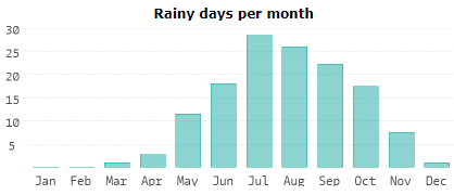
The months of July, August, and September recieve the most amount of rain. During these months, one can expect more the 25 rains of day, especially in July. 

Sun Light

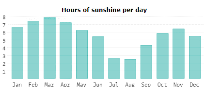
The average sun shine in Sierra Leone is illustrated below. One can expect the least amount of sun light during the months of July and August, with and average an of around three hours per day.

The Consulate of Sierra Leone in Syria

Follow the Consulate on social media for the latest news!

Website Map